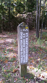
October Dayhike
I am posting this much later than the hike itself due to other things just getting in the way.
I found time to take one more Fall dayhike in 2016. This was in the Quehanna Wild area (again). I did two trails in one day (not hard to do in the Quehanna Wild area). The first was on the Bellefonte Posse Trail (I did a piece of it earlier in the year). This time I started from the parking area on the Quehanna Highway (located at the intersection of the highway and Wykoff Run Road).
 |
| Trail-head map |
 |
| Trail from parking area |
 |
From here the trail wanders a bit and I then came to a trail junction with a red blazed trail that was not on my map (I think it might have been the Kunes Camp trail - shown on another more up-to-date map). Knowing I had time and being a bit adventurous I took the red blazed trail. I followed this trail for about 10 minutes through the woods wondering where it went, it seemed to be going south and then turned towards the highway (I think). But as I wanted to make sure I did my intended hike I turned around and reached the Bellefonte Posse trail again. After an interval of hiking I reached some less woodsy area, seen below.
 |
| View from Bellefonte Posse Trail |
After another interval of hiking I reached the open area I had hiked to on a previous day-hike. It was much drier than before (and browner, of course). I stopped for lunch at the point where the trail goes back into the woods.
 |
| Lunch time view from the trail |
. After lunch I continued on the trail which I had earlier hiked and so contained no surprises. After a bit I reached the Reactor Road endpoint. From here I took the David Lewis Trail back to the parking area. At one point the blazes were not obvious and I took a worn but incorrect path for several minutes until I realized my mistake and backtracked. It was a bit anxiety inducing but I had some idea where I was and how to get back if I could not follow the official trail.
Having time for another hike in the area (as I had intended), I drove to the trail-head for the Powerline Loop Trail. This involved driving on the narrow dirt/gravel Old Wycoff Run Road for a few miles. Side note- sometimes getting TO the trail-head can be an adventure in itself.
I started from the small parking area for the trail (set up for cross-country skiing, but you would likely need to walk in or snowmobile in to ski it in winter).
 |
| Trail-head for Powerline Loop Trail |
 |
| Kiosk at Trail-head |
Anyway, I started hiking this trail which as you might guess is very straight (and gentle) which would be good for cross-country skiing. The one side of the loop does not follow a powerline and so is in the woods the whole time. But then it reaches the furthest point of the loop and turns left for a while and then reaches the powerline and a view seen below.
 |
| View on the Power Loop Trail |
The trail now follows the powerline swath back towards the road. Eventually the trail crosses from one side of the swath to the other side. Even though the blazes are further apart the trail is not hard to follow. Soon the trail reached the intersection with the Gore Loop Trail, seen below.
 |
| Intersection with Gore Loop Trail |
 |
| Red Blazed trail to left is Gore Loop Trail |
The the trail crosses the swath to go back into the woods here:
A five minute or so walk on the trail through the woods brought me back to the trail-head. Although ending my 2016 hiking season (not counting the short 'nature' walks in Tennessee at the end of October) was bittersweet the hikes themselves were very pleasant.

