Fall Day Hike on Billy Lewis Trail
I took one last day-hike for 2108. I picked the second half of the Billy Lewis trail due to its ease of access. The day of the hike (October 27) was rainy and cold (upper 30s), so not ideal hiking weather. I was dressed as warmly as practical for a hike - a fleece jacket, mittens, ear muffs, hat and my rain poncho. As you may recall the approximate mid-point of the Billy Lewis Trail is Patterson State Park which consists of a pavilion, a small number of picnic tables, a rest room and ancient water pump. I parked as out of the way as I could and started the hike going south where the trail roughly follows the roadway. As the trail is primarily intended for cross-country skiing this is acceptable although not highly desirable. It crossed the highway a couple of times before reaching a small parking area and heading away from the road,
 |
| One of the road crossings |
The trail is still wide and uses a woods road (wide although grassy) for some distance. It wass till raining and I was trying to keep warm and dry (nearly impossible to do both).
 |
| Trail leaving the roadside. |
 |
| The occasional sign indicating the direction |
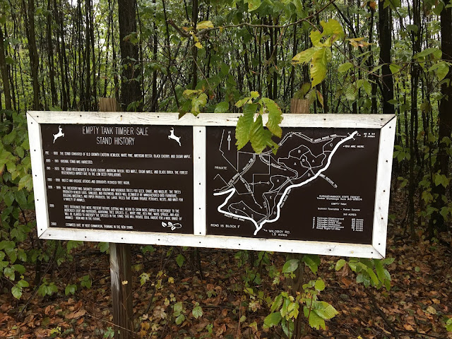
Eventually the trail came out to a road at one point. It passed by the below sign which I believe is a bit out of date.
 |
| Roadside sign describing timber sale history |
The trail went back into the woods soon after and started a gradual descent. It was typically still wide (for cross-country skiing). I was able to keep up a good pace despite the almost constant rain and cold. Due to the lateness of the season there were no leaves to protect me from the rain but fortunately there was not a lot of wind. After some more gentle ups and downs, passing some woods roads and some open areas I came out near the highway again, passing by the below sign. This indicated to me I was near Cherry Springs State Park.
 |
| Leaving the dirt road |
 |
| Park sign (one of several) |
Shortly after this sign I came to a road that intersected with the highway. I followed the trail here back around, popping out just down the road from the state park (btw Cherry Springs is well known in the amateur astronomy circles in the east as a special dark skies site). The picture below looks down the road towards the park which is on the left.
 |
| Looking towards Cherry Springs State Park |
Getting just back to the woods I stopped for lunch. I placed my rain poncho over me like a tent so I could eat while staying dry. I was sitting on damp ground so it was not the most pleasant lunch but I did it. After starting up again for the return hike I realized the stop had let me cool off and was starting to shiver. This meant I was in some danger of hypothermia given the low temperature and still constant rainfall, To combat that I started jogging instead of walking. I did this for about five minutes until I was sufficiently warmed to resume walking. I was damp enough that I had to be aware of letting myself get too cold. So I made sure I hiked at a vigorous pace, both to get back sooner and to keep myself warm. I finally reached my truck back at Patterson State park in little less time than it took me to hike out. Needless to say hiking in a cold rain leaves much to be desired but at least it was on a new-to-me trail for my last hike of 2018.


Comments